
Batavia Township Neighbors by Parcel
A Batavia Township neighbor lookup is most reliable when it stays at block scale. The county GIS map supplies parcel geometry, roads, address points, township and municipal boundaries, precincts, zoning, and related layers. The Auditor then supplies a separate property record for a selected parcel. Recorder instruments can add a title or plat relationship when that matters. The Board of Elections is the custodian for defined public registration-list questions. CCGS and the Batavia library provide historical context, not a present-day roster.
| Source | What It Shows About a Block | Access |
|---|---|---|
| Clermont GIS | Parcel shapes, roads, address points, and map layers around an address | Free county map; its graphical data carries an accuracy disclaimer. |
| Auditor address search | Individual parcel, owner, sale, and assessment context | Free search, one parcel at a time. |
| Recorder CountyFusion route | Recorded instruments, plats, and legal-description chain for a parcel | Online documents from 1980 to present; counter and request path for older material. |
| Clermont Board of Elections | Defined public precinct registration-list question, subject to exclusions | Inspection or request through the custodian, not a free-form block list. |
| CCGS and Batavia library | Newspapers, maps, census, obituary, cemetery, and surname research | Online databases and in-library collection access. |
The owner field is an ownership fact, not a claim about every person at a property. GIS identifies the physical lot. The Auditor’s parcel card may show a Full Address and separate mailing-address fields. The Recorder can establish a recorded transaction, while voter data has statutory privacy exclusions. Those differences protect the reader from turning an address search into an unsupported account of who the neighbors are.
Note: The correct block method compares one official record type at a time, rather than combining unrelated names into a presumed household.
Map a Batavia Township Block
The official Clermont Auditor GIS Web App starts with Address, Address Points, Owner, Parcel, and other map search bases. Search the subject address, then use the returned parcel to orient the block. The county’s map guidance says a partial address or road name can help when a full query fails. A returned parcel can be marked with a red outline. From there, identify the surrounding polygons individually instead of assuming that a road name alone identifies the same subdivision lot or legal parcel.
- Find the subject address or parcel in GIS and note the PIN, Full Address, road geometry, and displayed township or municipal layer.
- Use the identify or left-click popup on each adjacent polygon. Record each PIN separately and avoid treating a polygon edge as a certified legal boundary.
- Search each PIN or address in the Auditor property record. Compare the situs field with the MADDR mailing components before describing an owner relationship.
- When a deed, plat, declaration, or street-change question matters, move from the parcel’s legal description to the Recorder’s search or counter request.
The process is address to GIS parcel, GIS parcel to Auditor record, then legal description to Recorder instrument. It maps the immediate block without pretending that the map is a resident list. For a full named-street sequence across many parcels, the Batavia Township street directory uses the broader address-by-address trail.
GIS also allows point, line, extent, polygon, freehand-polygon, and buffered selections. Those tools help compare nearby parcels, but a buffer is a map selection method, not evidence that people on all selected lots know one another.
Batavia Township Neighbor Property Records
The Auditor’s online modes separate address, owner, parcel, map, and advanced searching. A direct address search is appropriate when the property is known. The owner mode expects last name then first name, accepts partial text and an asterisk wildcard, and can sort results by Parcel ID, Owner Name, Parcel Address, Last Sale, or Price. Those search features are useful for locating a property record, but they are not a way to establish the current membership of a household.
On the GIS parcel view, Full Address is the site or situs field. MADDR1, MADDR2, and MADDR3 are owner mailing-address components and can differ from the situs. That separation matters often on a block. A person may receive tax correspondence away from the property, and a property may have people connected to it who do not appear as the owner. Keep the exact field label in any note taken from a screen.
The Recorder’s role begins when an actual title event or legal description needs review. Its records include deeds, mortgages, certificates of transfer, easements, plats, annexations, centerline surveys, street-name changes, and street or alley vacations. Search the relevant owner or party name, then check the document type, date, party role, and legal description. A nearby mailing field or a similar road name does not replace that document-level comparison.
Batavia Township Neighbor Zoning Files
A defined address and project question can lead to a Township zoning or permit file. Batavia Township Planning and Zoning is the custodian for Township address matters at 1535 Clough Pike. The office’s regular hours are Monday through Friday, 8:00 a.m. to 4:30 p.m., and its phone number is 513-732-3888. Its forms describe applications for structures, fences, pools, signs, right-of-way work, and Board of Zoning Appeals matters, but no general public historical permit search was verified.
Ask for a precise record under ORC 149.43: identify the address or parcel ID, permit or certificate type, date range, and desired attachments or decision notices. A current residential application can capture owner, contractor, building address, subdivision, lot, cross street, parcel ID, project information, setbacks, and certificate number. The custodian must still review responsive material for statutory exemptions. A zoning application is evidence of an address-specific project, not proof of residence.
The county Township zoning contacts resource is pictured below. Check the GIS boundary before directing a record question, because a Batavia postal address does not itself decide whether the Township or Village of Batavia is the custodian.
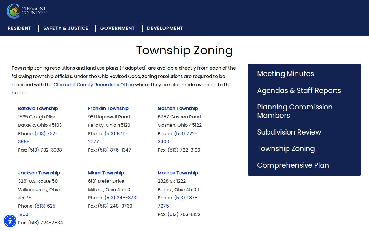
Boundary verification prevents a neighbor inquiry from being sent to the wrong planning office when Township, Village, and postal labels overlap.
Batavia Township Neighbors and Civic Records
Ohio’s state voter lookup requires first name, last name, and county. Clermont Voter View requires first name, last name, and date of birth, with an optional suffix. The state system may offer a street selection only after an individual result. Neither interface is a public browse tool for all Batavia Township neighbors on a block. A defined Board of Elections inspection or request is the appropriate path for a public precinct-list question.
ORC 3503.13 excludes Social Security information, driver-license and state-ID information, telephone numbers, email addresses, proof of citizenship, protected worker addresses, and confidential Safe at Home records from public voter disclosure. ORC 3503.26 provides an inspection and copying route for current precinct lists when not in official use, subject to those protections and election-related limitations. The DATA Act archive can supply dated county registration snapshots, but its public files are not a practical or appropriate block roster.
| Community source | What research verified |
|---|---|
| Neighborhood associations, HOA groups, block watch, and congregation rosters | No verified Township-wide public directory or authoritative roster was located. |
| Batavia Township public-hearing and zoning records | Defined address or project files may be requested from the proper Township custodian. |
| CCGS and Doris Wood Batavia Branch | Historic newspapers, maps, census, obituaries, cemetery records, and surname material can supply local context. |
That research gap is important. Public sources can establish parcel geography, title, civic records within the law, and historical context. They do not create a verified community directory. The safest course is to use a known address and a defined public-record question, then leave private associations and unverified personal listings out of the result.
Note: A public record can describe a parcel or proceeding without identifying all people who may be associated with that address.
Batavia Township Neighbor Source Comparison
Official records identify their custodian, field limits, and time frame. Nonofficial neighbor-listing tools may combine older public records, private submissions, and unknown update dates. That difference matters when an address changes, a parcel is sold, a person uses a protected address, or a record is corrected. Use a county or state custodian when a source must be checked, and never publish or repeat personal information that a law keeps protected.
| Official block records | Nonofficial neighbor listings |
|---|---|
| Identify the agency, record date, parcel or case reference, and statutory exclusions. | May not identify the original source, update date, or correction route. |
| Auditor, GIS, Recorder, Board, and Township staff can explain their own records. | Information can mix owner, mailing, and historic data without showing the distinction. |
| Defined requests have a custodian and an Ohio Public Records Act process. | Private copies cannot amend the public record held by a government office. |
Ohio’s privacy guidance is custodial. ORC 149.45 permits requests to redact defined sensitive personal information from an online public record, but it does not erase a valid recorded land fact. Safe at Home is a separate state confidentiality process for qualifying people. If a public record contains an error, contact the office that created and maintains it rather than trying to infer a correction from a third-party list.
Batavia Township Neighbor Geography
Batavia Township and the Village of Batavia are separate jurisdictions even though county offices, the library, and many postal addresses use Batavia. Part of the Township’s broader edge also carries Amelia postal geography. GIS township, municipal-boundary, parcel, road, and address-point layers are the reliable way to see the government geography attached to an address. A postal label alone does not decide which zoning office or local record applies.
For older block context, CCGS identifies 1870 and 1891 property-owner maps as a member resource, and the Library of Congress provides an 1885 Batavia Sanborn map for its mapped settlement area. The Batavia Branch holds Clermont County newspaper microfilm from 1814 forward. These sources can explain road names, nearby structures, obituary references, or an earlier landowner, but they should be paired with a legal description and the correct time period. The 1885 map does not cover all modern Township acreage.
Records also preserve a long local trail. Clermont County was established in 1800, the Recorder has archived land documents for two centuries, and the present Records Center reports 6,500 historical journals and plat books. The modern Recorder web-image range begins in 1980, which is an online access boundary rather than the start of county history. For an earlier parcel question, the Recorder counter, Records Center guidance, library, maps, and newspapers remain part of the documented fallback chain.
Batavia Township Neighbor Lookup Limits
Parcel maps and property rolls cannot show every person associated with an address. Utility, delivery, and motor-vehicle personal data are not substitutes for a parcel record. Public voter information is limited by statute, and Safe at Home participants are omitted from public voter versions. Juvenile, sealed, expunged, adoption, and protected court material also cannot be assumed public. A nearby property is a geographical relationship, not permission to investigate private life.
When a narrow record is needed, ask the owning office for the correct route. The Clermont County Sheriff’s public-records request information is one example of a custodian channel for a defined record rather than a broad name search.
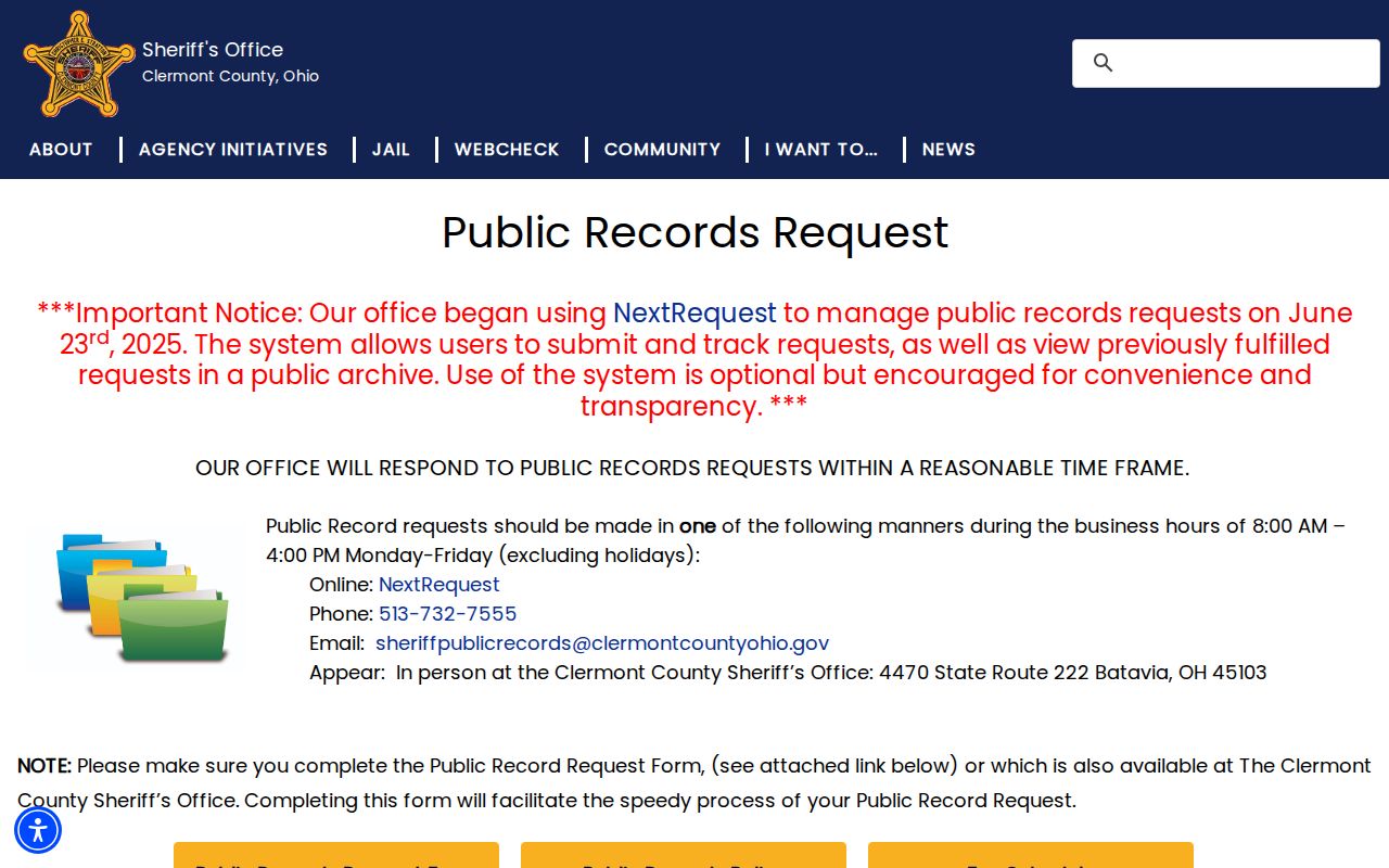
A request should identify a record type, date range, and location clue so the relevant agency can apply its own disclosure rules.
Lawful use. Use neighbor records for a lawful, specific civic, property, or family-history question. Do not use Batavia Township neighbor information to stalk, harass, intimidate, or harm another person.
Note: The proper custodian can release nonexempt material, explain a redaction, or identify the correct records office for a defined question.